Measure Distance Between Two Points in Google Maps
Google Maps can measure the straight-line distance between any two points - and keep going, adding points to measure a whole path. Right-click your starting point, choose Measure distance, then click each point on the map.
- SystemWindows (browser)
- AppGoogle Maps web app
- Last verifiedNovember 22, 2026
Every screenshot below is taken from the actual recording on this device — no stock images.
Steps
Open Google Maps
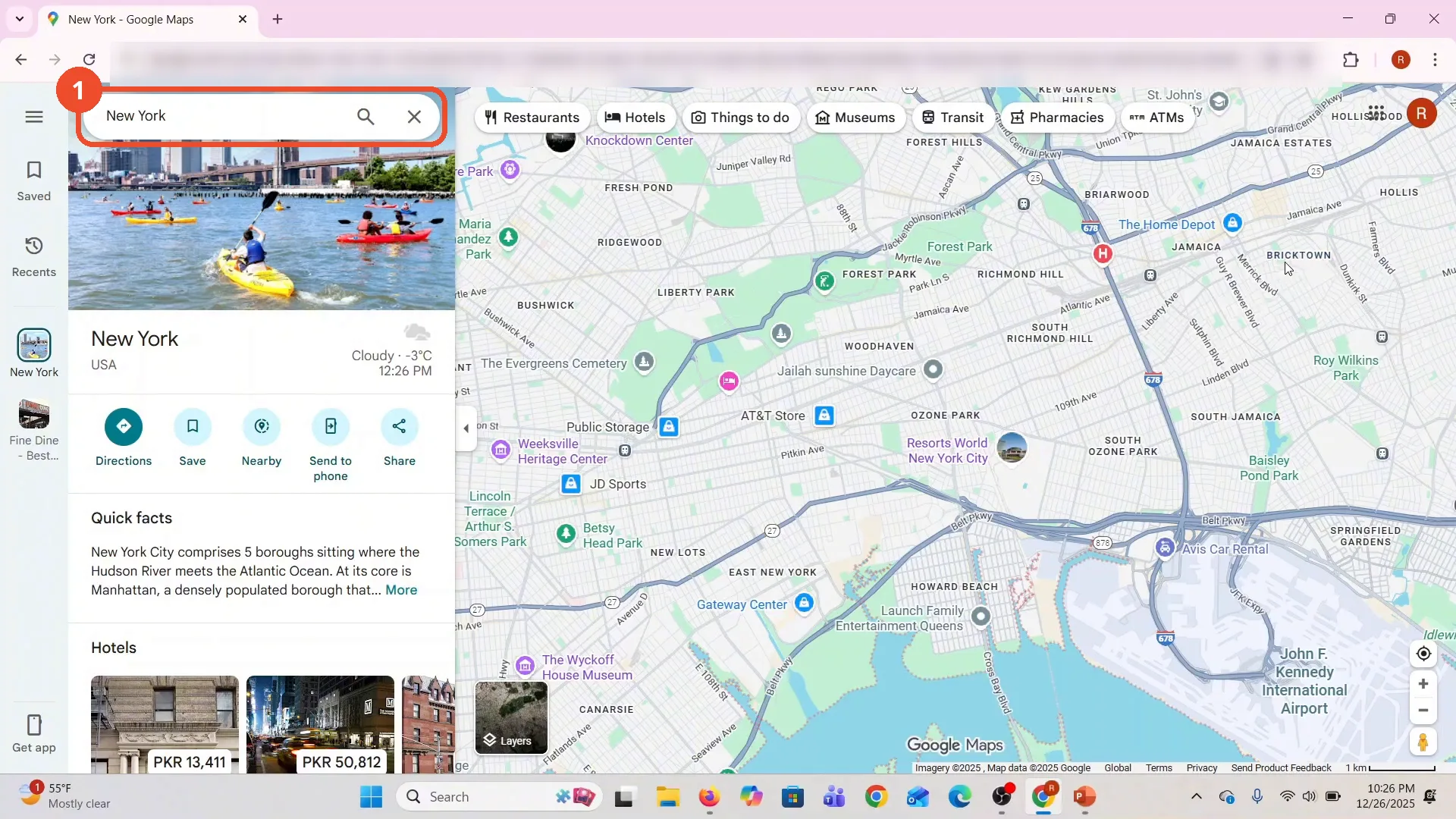
Open Google Maps in your browser. The film opens on New York, with the New York place card on the left.
Right-click your starting point
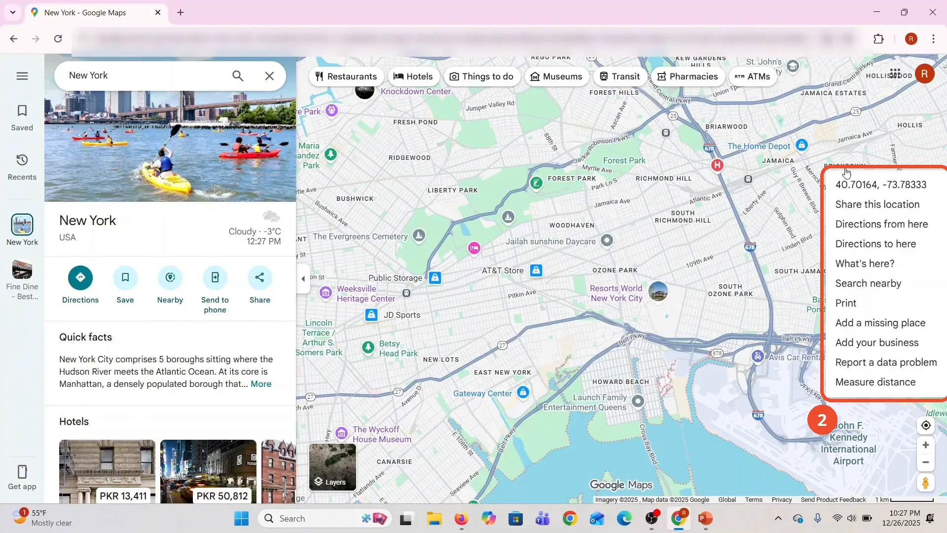
Right-click the spot you want to start measuring from - the film picks a point near Bricktown, Queens. The menu shows that point’s coordinates, 40.70164, -73.78333, at the top.
Click Measure distance
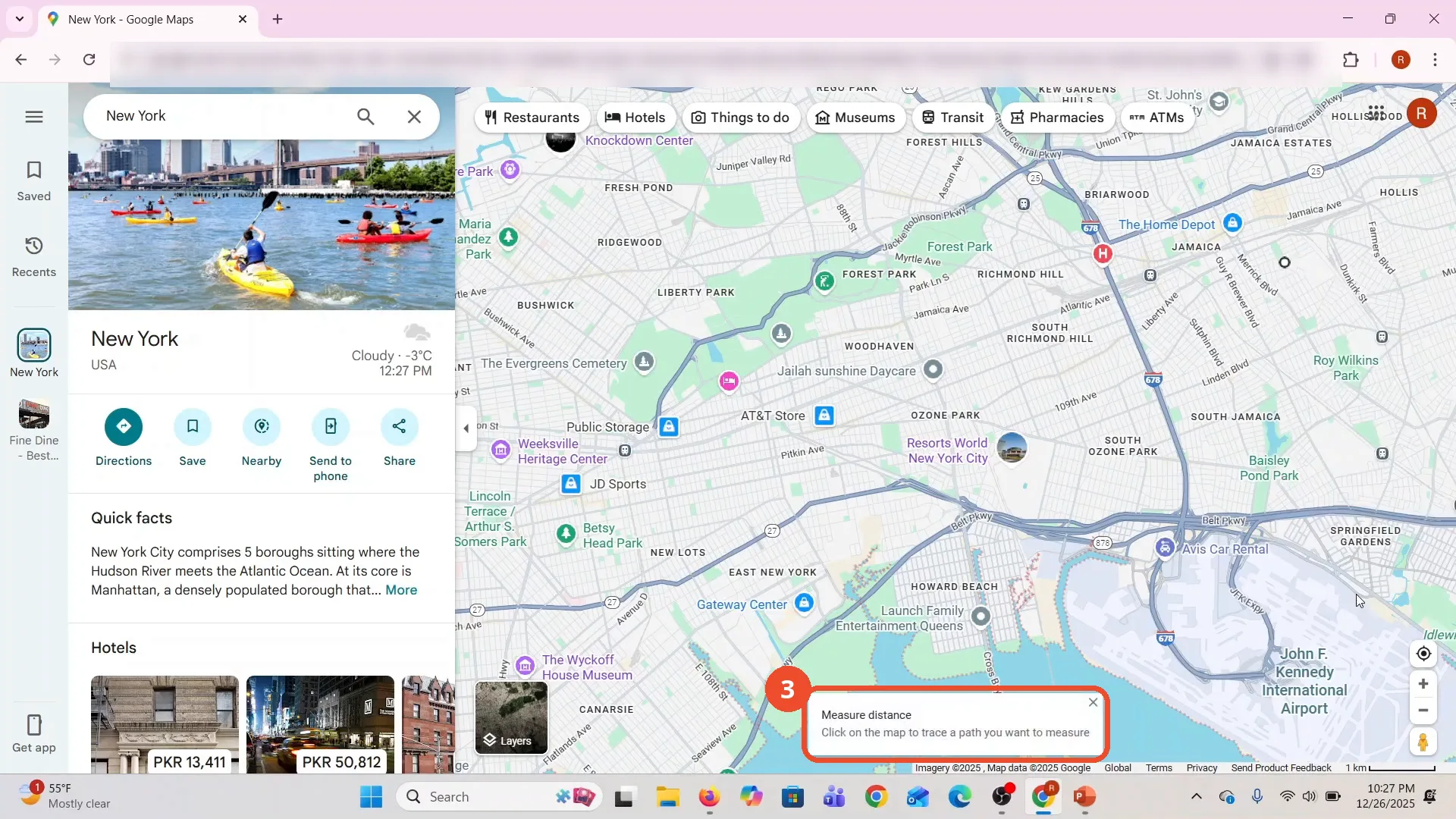
Click Measure distance at the bottom of the menu. Google Maps switches to measuring mode and a card appears: Click on the map to trace a path you want to measure.
Click a second point
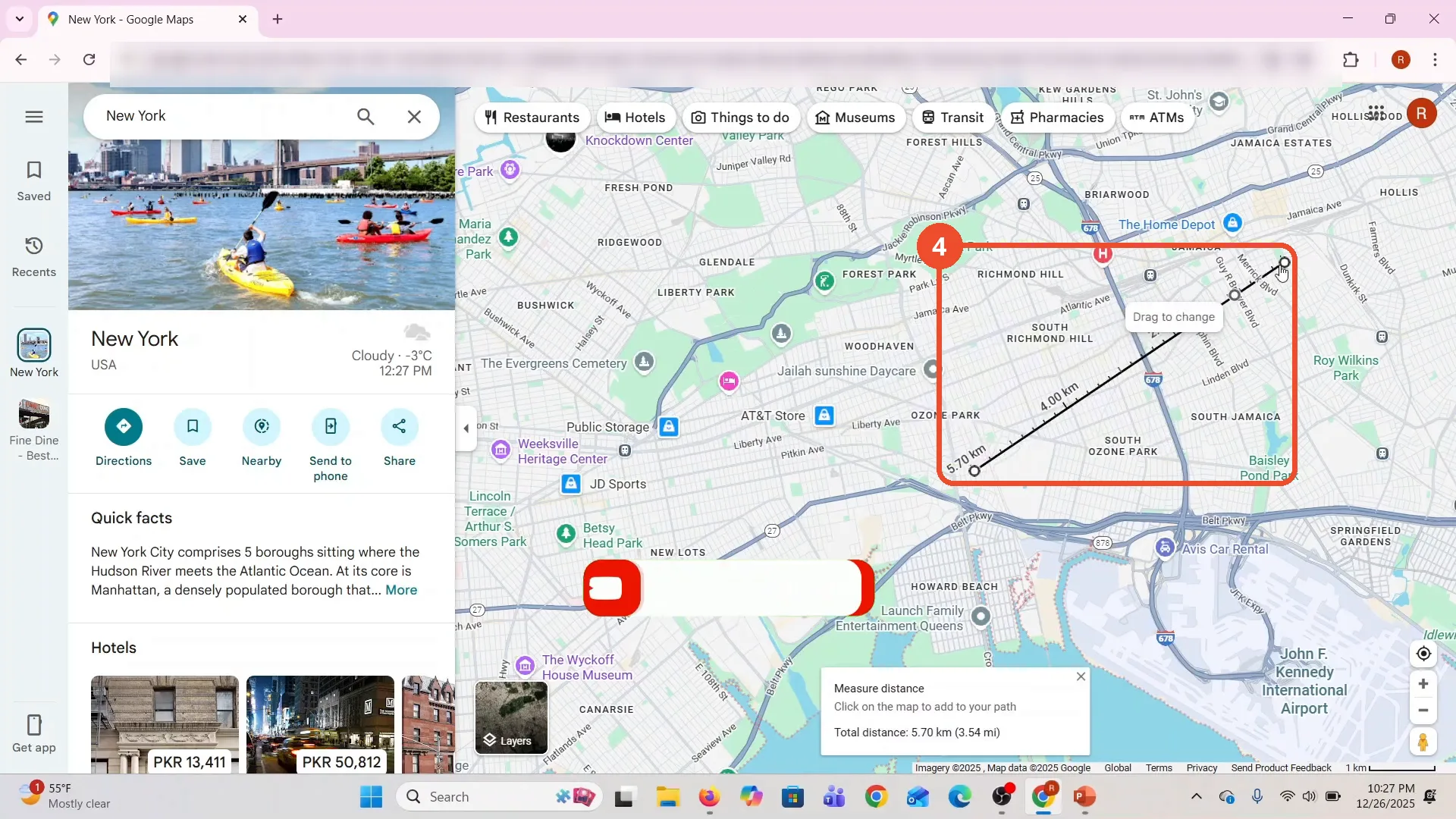
Click the second point on the map. A line connects the two points and the card shows the running total: 5.70 km (3.54 mi). The points can be dragged to adjust them.
Click more points to extend the path
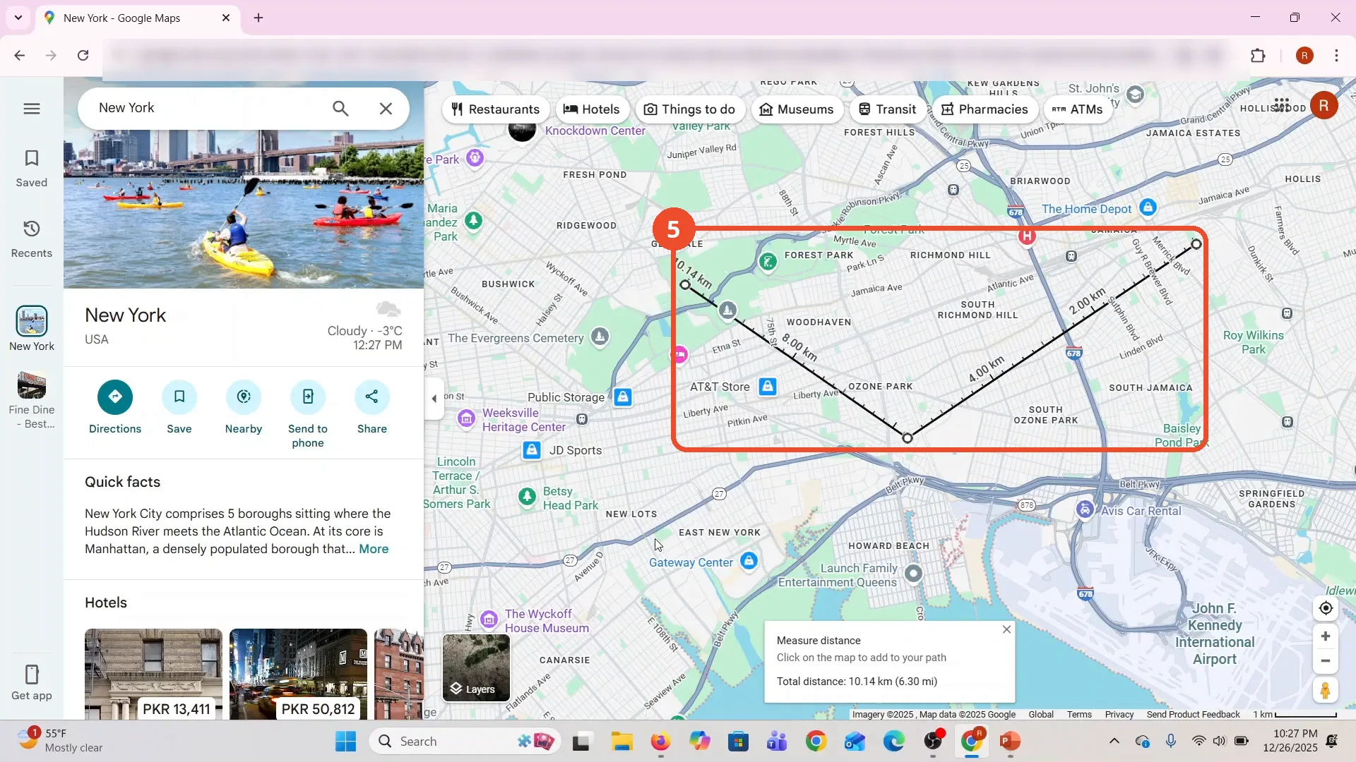
Keep clicking to add points - the film adds a point near Forest Park and the total grows to 10.14 km (6.30 mi). The labels along the line show the running total at each point.
Read the total distance
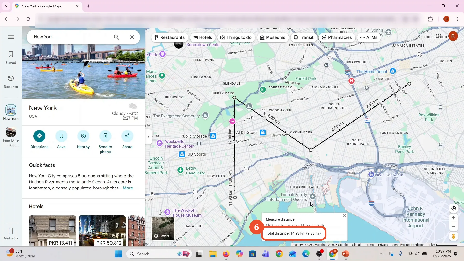
The film finishes with a path of several points across Queens. The card shows the final total: 14.93 km (9.28 mi). Close the card with its X when you are done measuring.
Good to know
- The film measures straight-line distances between the points you click - not driving or walking routes. The total is the length of the path you trace.
- The distances the film measures are for the points it clicked in Queens, New York: 5.70 km for the first leg, 10.14 km after the third point, and 14.93 km (9.28 mi) for the finished path.
- The points you place can be dragged to a new spot - hover a point and Google Maps shows Drag to change - and the total updates as you drag.
- The film starts with a What’s here? card already open for an earlier point in Queens; it closes that card before starting the measurement. The right-click menu works the same from a clean map.
More on Google Maps
- How to Fix Blank Google Maps in Firefox
- How to Track Family Members on Google Maps
- How to Get Compass on Google Maps
- How to Change Routes in Google Maps
- How to Change the Year in Google Maps and View Past Locations
- How to Change Google Maps from Walking to Driving
- How to Pin Multiple Locations on Google Maps
- How to Remove Labels from Google Maps
- How to Change Vehicle Icon on Google Maps
- How to Delete Saved Trips on Google Maps
- How to See Elevation on Google Maps
- How to Add Multiple Stops on Google Maps
- Blur Your Home on Google Maps to Protect Your Privacy
- How to Avoid Toll Roads on Google Maps
- How to Create a Walking Route on Google Maps
- How to Find Latitude and Longitude on Google Maps
- How to Delete Google Maps History and Manage Your Privacy
Guide complete
Every step above comes from the original recording, with a screenshot for each step. Want more like this? Browse all Google Maps guides.