How to Change Routes in Google Maps
Google Maps draws the fastest route first, but you can reshape it by dragging the blue line. This tutorial follows the film exactly: get directions from the Montclair Art Museum to The Wellmont Theater, drag the route to a new path, and check the updated time in the panel.
- SystemWindows (browser)
- AppGoogle Maps web app
- Last verifiedNovember 17, 2026
Every screenshot below is taken from the actual recording on this device — no stock images.
Steps
Open Google Maps and click Directions
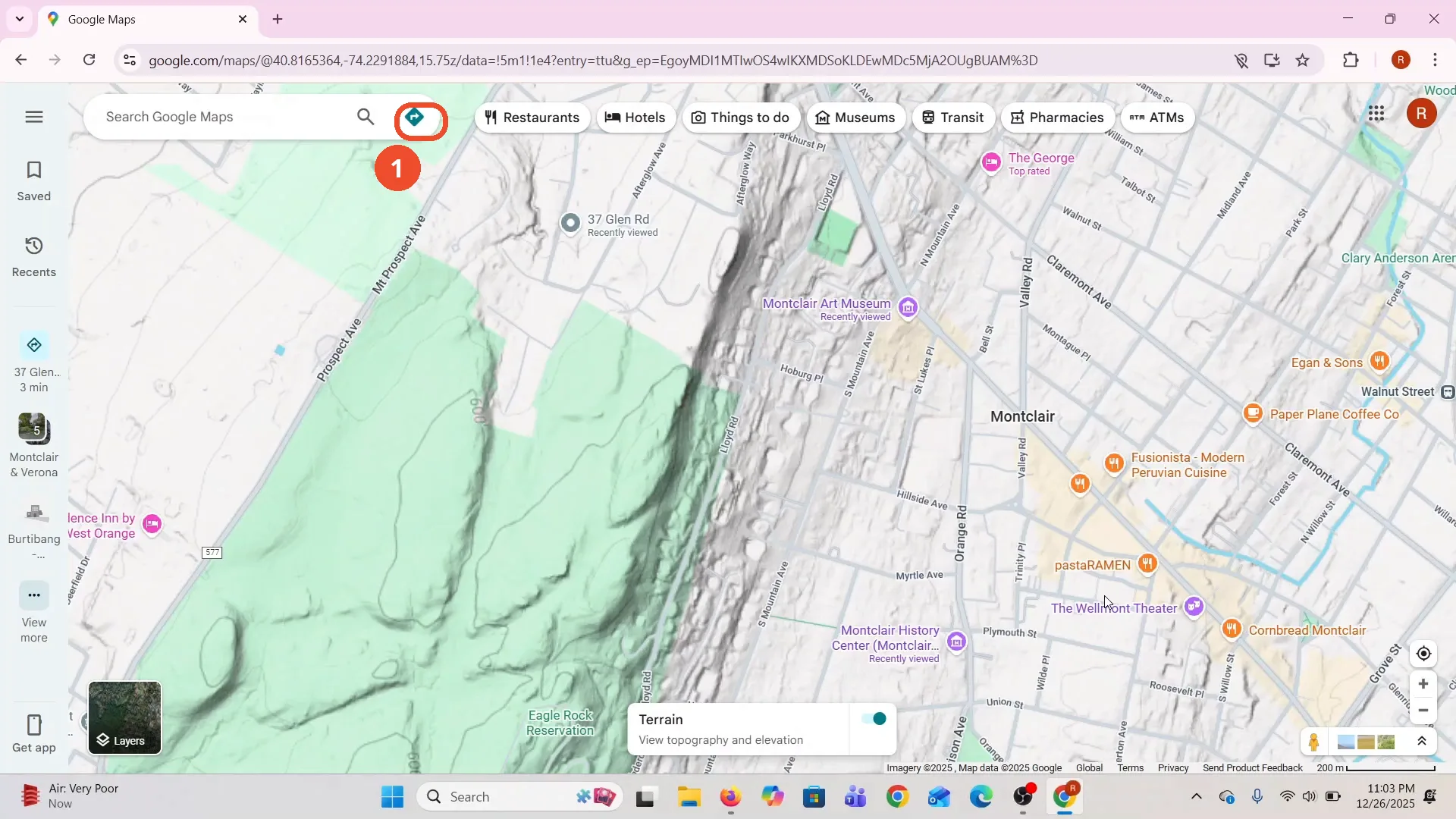
Open Google Maps in a desktop browser. The film opens on Montclair, New Jersey. Click the Directions diamond at the top, next to the search box.
Choose the starting point
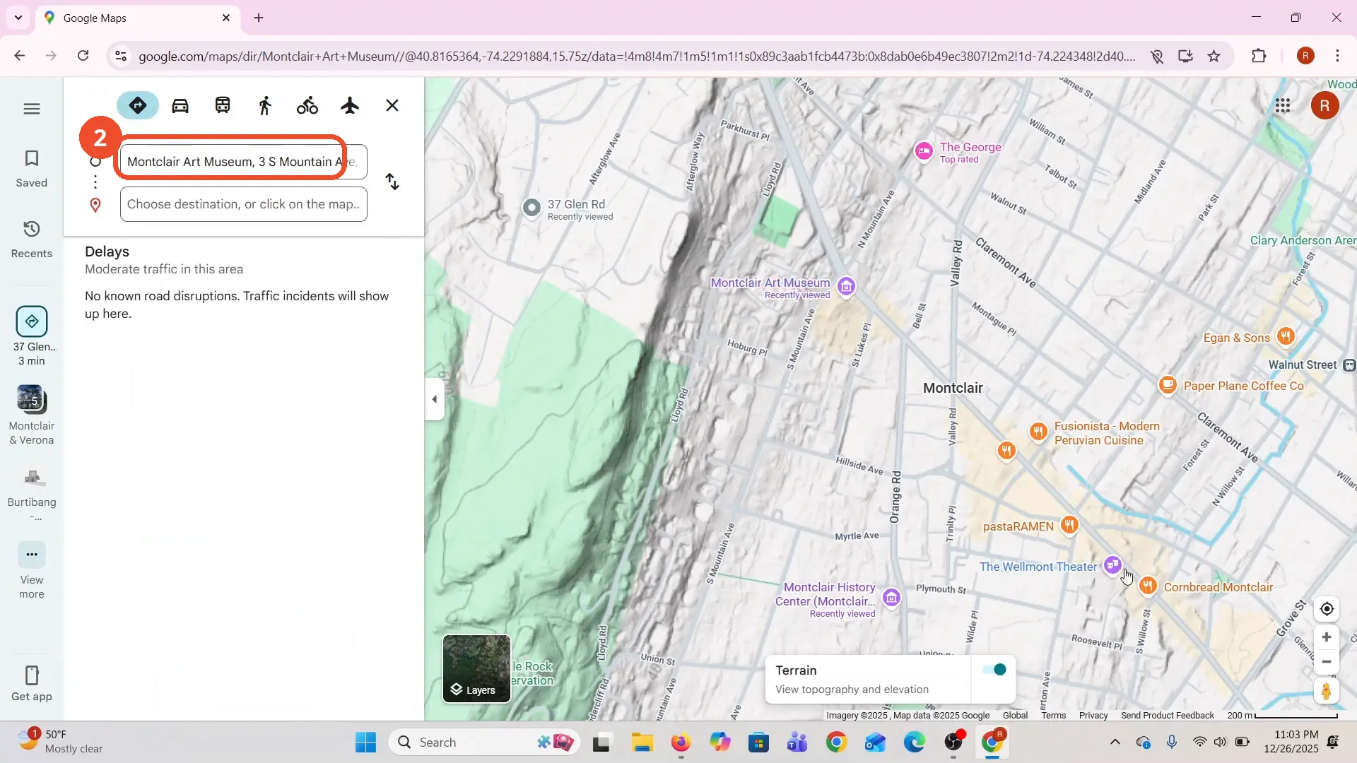
Click the starting-point field and pick a place. The film picks Montclair Art Museum, 3 S Mountain Ave, from the suggestions.
Choose the destination
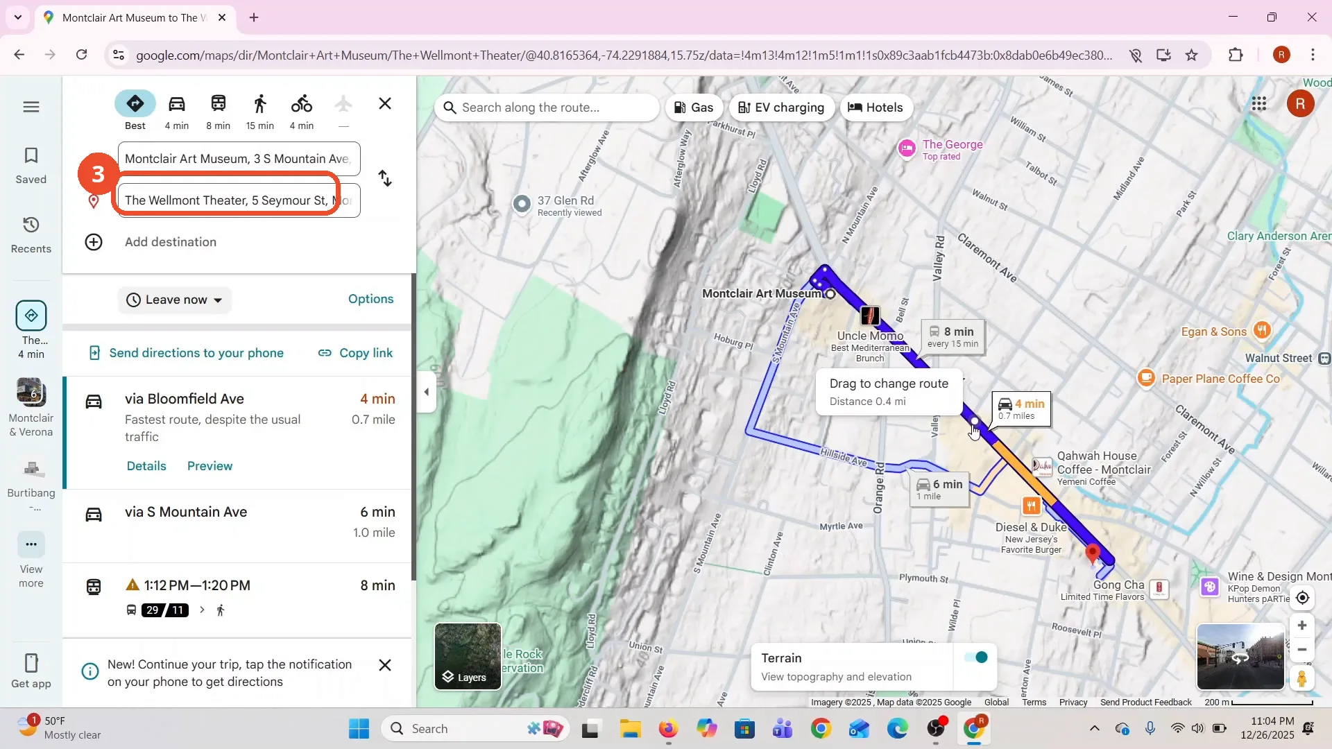
Click the destination field and pick a place. The film picks The Wellmont Theater, 5 Seymour St. Google Maps draws the fastest route at once: via Bloomfield Ave, 4 min, 0.7 mile.
Drag the route to a new path
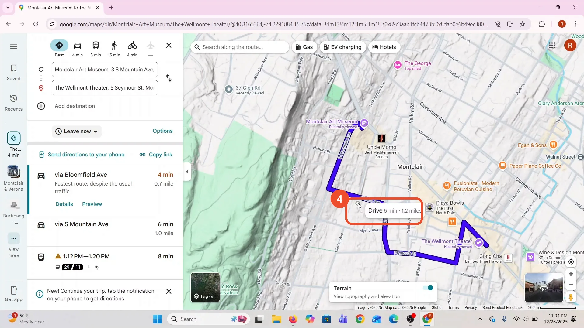
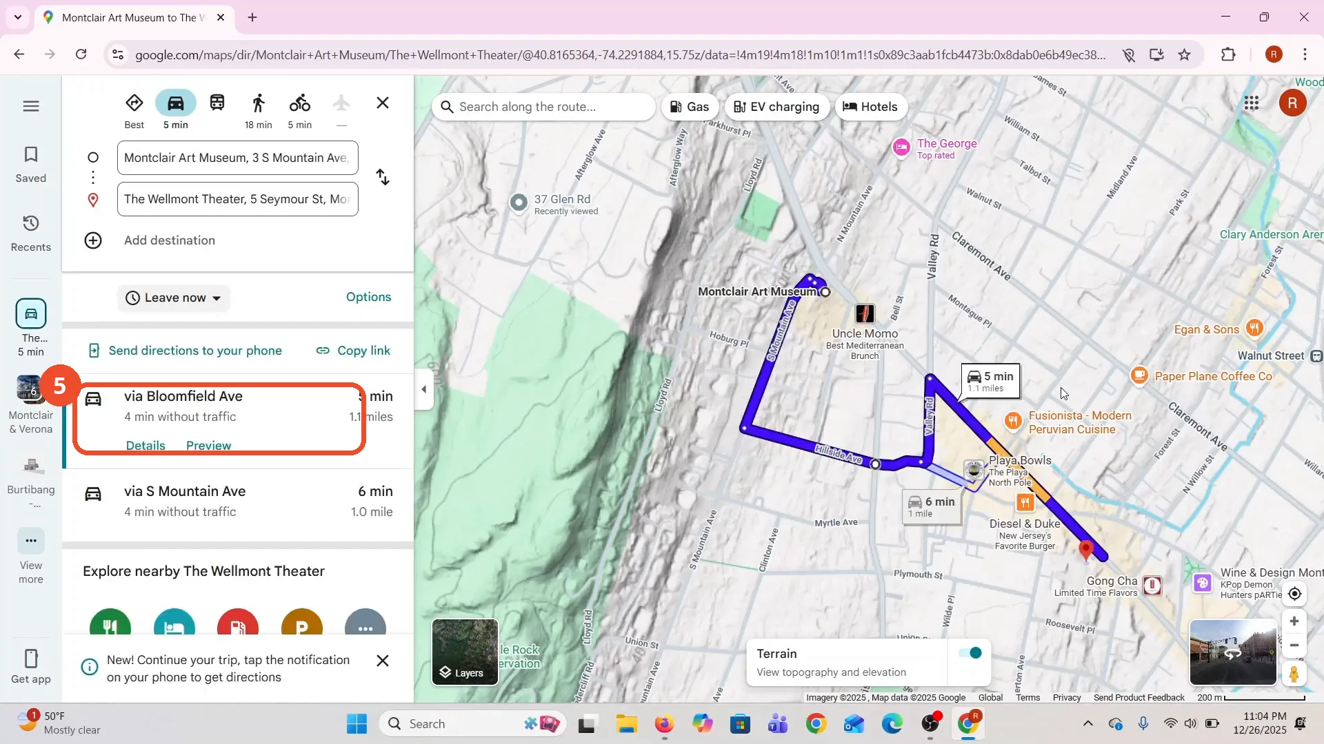
Grab the blue route and drag it where you want to go. The film drags the route west into a detour, and the label reads “Drive 5 min · 1.2 miles”.
Check the changed route
Release the route and look at the panel: via Bloomfield Ave is now 5 min and 1.1 miles, up from 4 min and 0.7 mile before the drag. The route has changed.
Good to know
- The drag changes the route: via Bloomfield Ave goes from 4 min and 0.7 mile to 5 min and 1.1 miles. The left panel updates as soon as you release the route.
- The narration says you can also add stops, but the film never adds one on camera. The “Add destination” field stays empty throughout.
- The starting point and destination are the film’s own picks, in Montclair, New Jersey. Pick your own places the same way.
- The directions panel also lists a second option, via S Mountain Ave, 6 min and 1.0 mile. Dragging changes the fastest route, not the list of options.