How to Change Google Maps from Walking to Driving
Google Maps lets you switch a trip between driving, transit, walking, and cycling from the bar at the top of the directions panel. This tutorial follows the film exactly: get directions from The MC Hotel in Montclair, look at the travel-mode bar, and switch the trip to driving.
- SystemWindows (browser)
- AppGoogle Maps web app
- Last verifiedNovember 18, 2026
Every screenshot below is taken from the actual recording on this device — no stock images.
Steps
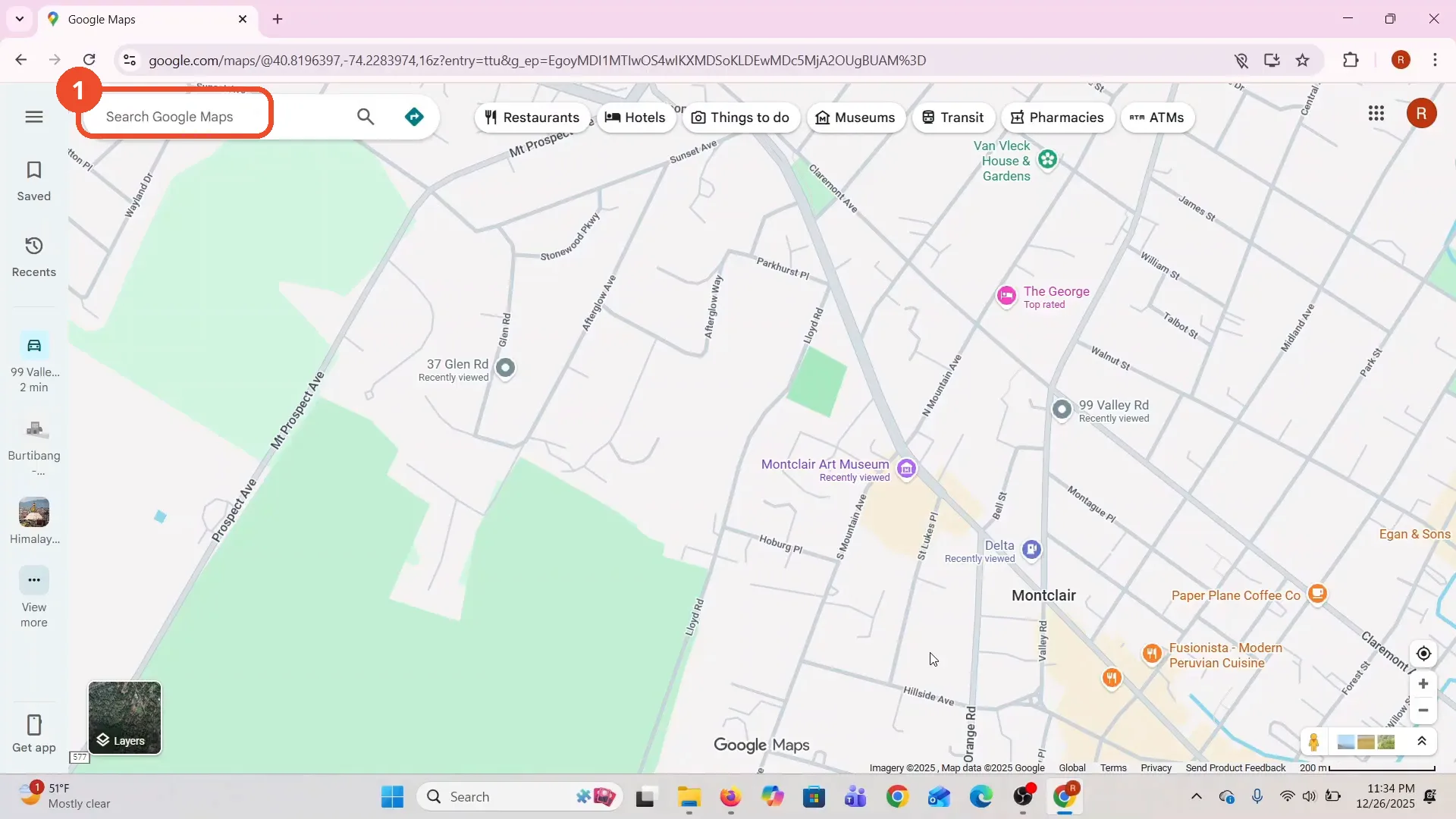
Open Google Maps
Open Google Maps in a desktop browser. The film opens on Montclair, New Jersey.
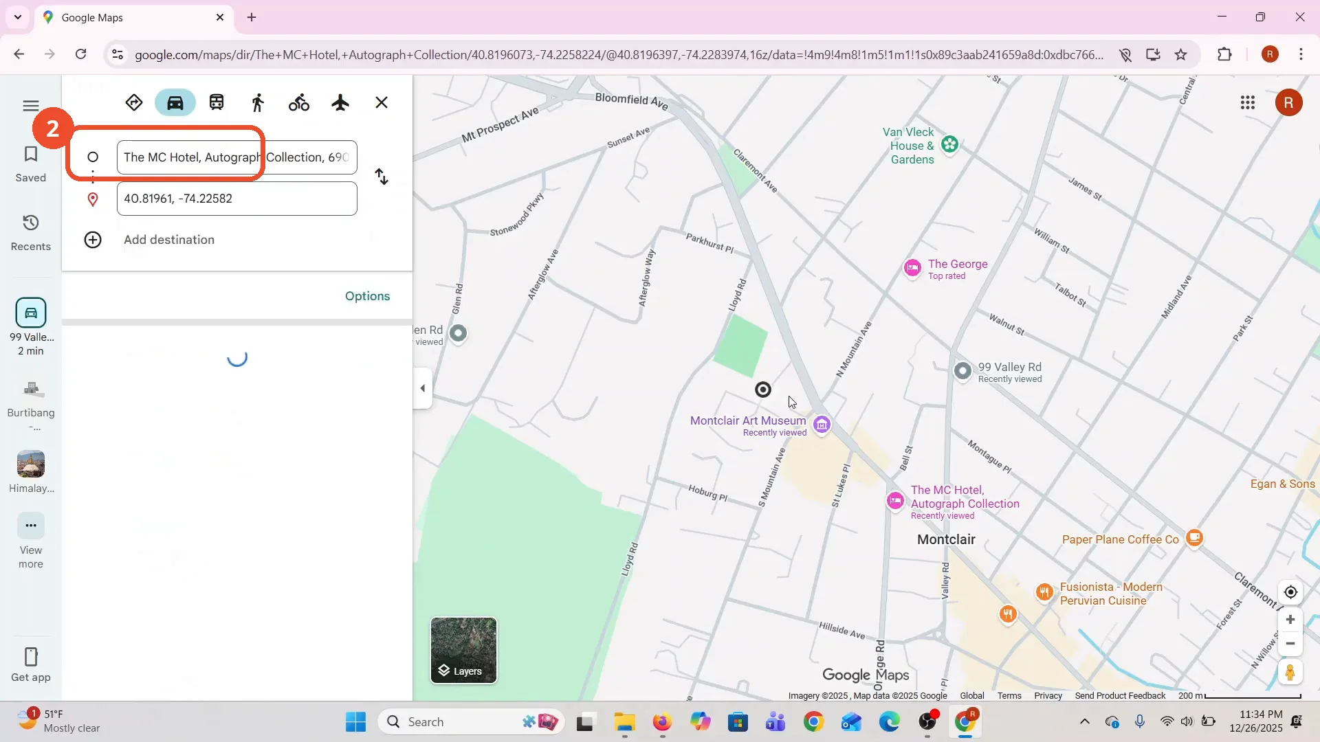
Choose the starting point
Click the Directions diamond at the right end of the search box, then click the starting-point field and pick a place. The film picks The MC Hotel, Autograph Collection.
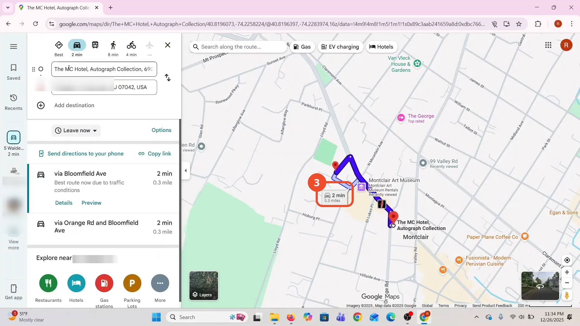
Click the map to set the destination
Click on the map where you want to go. The film clicks near the art museum; Maps drops a pin, turns it into a street address, and draws the route: via Bloomfield Ave, 2 min, 0.3 mile.
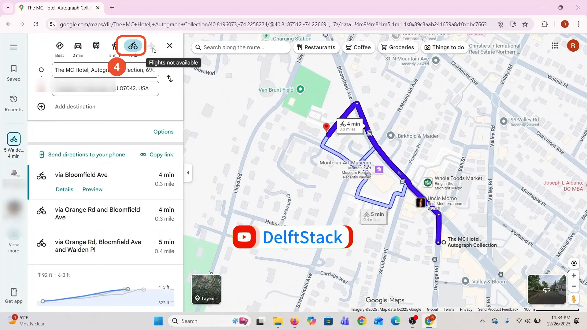
Try the other travel modes
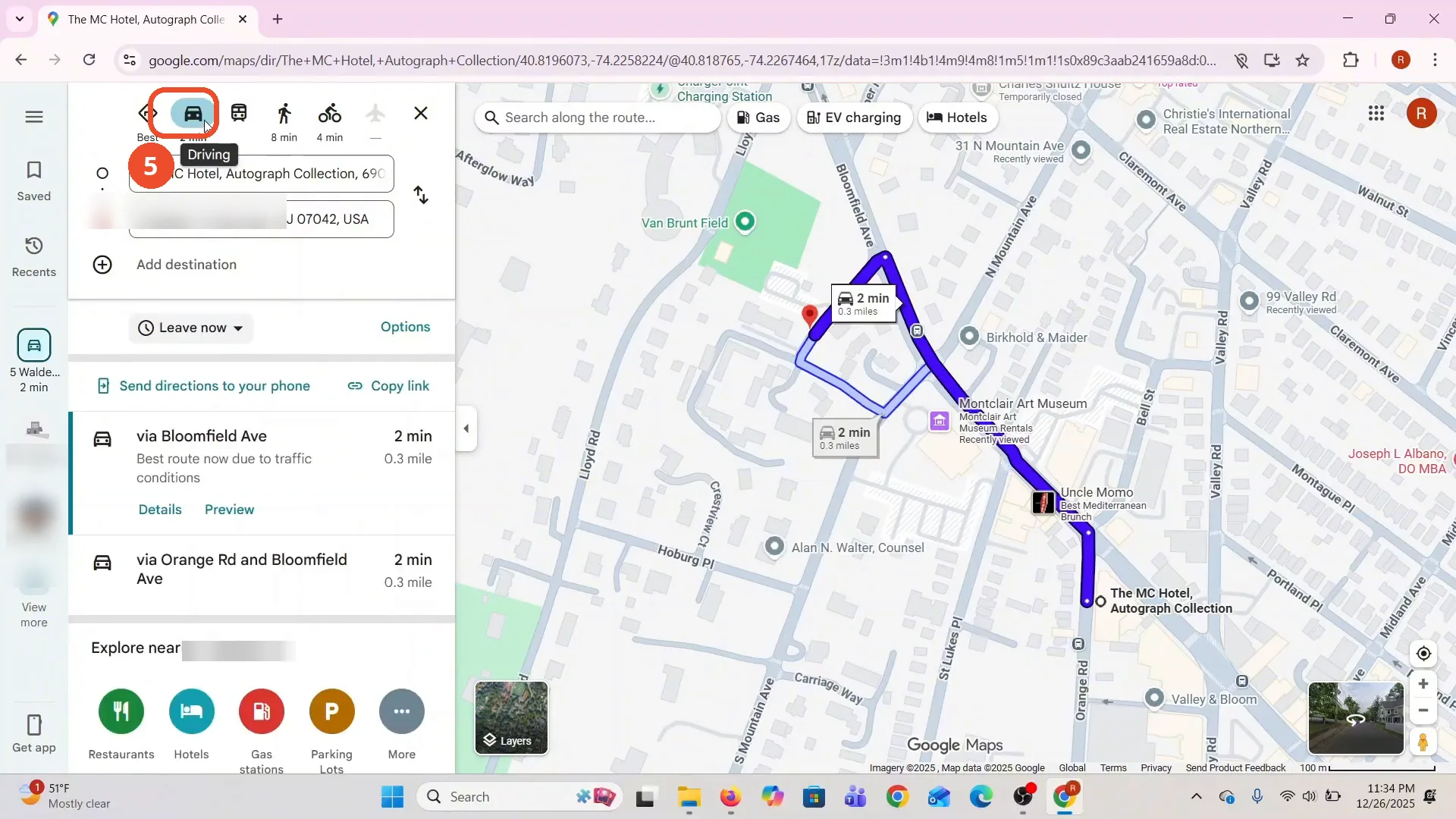
The bar at the top of the panel lists a time for each mode: driving 2 min, walking 8 min, cycling 4 min. The film clicks the cycling icon, and the same trip by bike is 4 min via Bloomfield Ave, with an elevation profile at the bottom of the panel.
Click Driving and check the driving time
Click the car icon at the left of the mode bar. The route switches back to driving: via Bloomfield Ave, 2 min, 0.3 mile - the fastest route.
Good to know
- The narration says Directions only shows the walking distance, but the film never shows a walking route on camera: the car icon is already highlighted when the panel opens, and the first route is driving, 2 min. The walking figure, 8 min, appears only as a number under the walking icon.
- The switch the film actually shows is cycling to driving: the same trip by bike is 4 min via Bloomfield Ave, with an elevation profile at the bottom of the panel, and driving is 2 min.
- The destination is the film’s own pick, a home address in Montclair; the start is The MC Hotel. Pick your own places the same way.
- Hovering the plane icon says ‘Flights not available’ - there is no flight option for a trip this short.
- Nothing here is dragged: the route keeps the same shape, only the travel mode changes.
More on Google Maps
- How to Fix Blank Google Maps in Firefox
- How to Track Family Members on Google Maps
- How to Get Compass on Google Maps
- How to Change Routes in Google Maps
- How to Change the Year in Google Maps and View Past Locations
- How to Create a Walking Route on Google Maps
- How to Pin Multiple Locations on Google Maps
- How to Remove Labels from Google Maps